


230424

mzonzon05
User
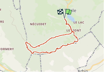

Length
9.1 km

Max alt
1197 m

Uphill gradient
437 m
Km-Effort
14.9 km

Min alt
887 m

Downhill gradient
437 m
Boucle
Yes
Creation date :
2023-04-23 10:01:33.215
Updated on :
2023-04-23 13:59:15.51
3h57
Difficulty : Easy

FREE GPS app for hiking
 SityTrail
IGN / Geographical institutes
SityTrail Plus
The world is yours!
About
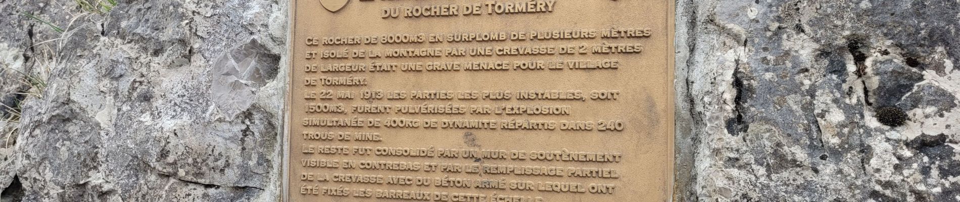
Trail Walking of 9.1 km to be discovered at Auvergne-Rhône-Alpes, Savoy, La Thuile. This trail is proposed by mzonzon05.
Photos


Positioning
Country:
France
Region :
Auvergne-Rhône-Alpes
Department/Province :
Savoy
Municipality :
La Thuile
Location:
Unknown
Start:(Dec)
Start:(UTM)
269885 ; 5046044 (32T) N.
Comments